Unexplored Basin
Basin Status
Foreland
Tectonic Setting
0
Area (km2)
0
Visitor Count
0
Likes
Executive Summary
of
Ampana Basin
Description
Version
1
Published Date
20 Jan 2023
Uploaded Date
-
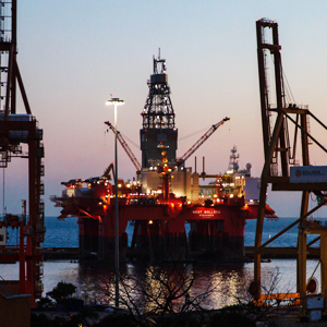
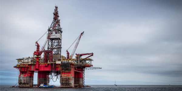
Photos
Some footage of Ampana Basin


Introduction
Preliminary details of Ampana Basin
The Ampana Basin is a tertiary basin which is tectonically included in the fore arc basin. This basin is between the northern and eastern arms of Sulawesi Island. Administratively, this basin is included in the Tojo Una-Una Regency, Central Sulawesi, with a basin area of 2,266 square km in offshore location. Research was carried out in the Ampana Basin by E. Kundig in 1956, besides that it was also carried out using the seismic method by Fugro MCS-Searcher until 1971, but no drilling wells were found at this location. In addition, surface geological research on the Tomini Basin was also conducted in 2013 by the Center of Geological Survey. The presence of many gas and oil seeps in this location indicates the existence of a developing petroleum system in this basin.
Data based on:
20 Jan 2023
Exploration History
Detailed history of Ampana Basin
Data based on:
20 Jan 2023
Regional Geology
Detailed regional geology of Ampana Basin
Research on the Ampana Basin produced several data, the main of which were measurements and sampling of the Bongka Formation. This formation is composed of alternating marlstones, fine-grained sandstones, shales, siltstones and conglomerate sandstones, some thermally exposed sandstones, Late Miocene to Pliocene in fluvial to pro-deltaic environments. From TOC analysis and pyrolysis several samples were taken from the Podi Bae River. From the results of the TOC analysis in track-2 of the Podi Bae River, the Ampana Basin region has the same TOC percentage values between 0.4 to 0.6 percent with the Tinombo Formation in the Tomini Basin region, which is Eocene–Oligocene age, as the source rock. Based on the results of preliminary research, the Ampana Basin is composed of Pre-Tertiary to Recent rock units, namely the Mafic Complex, Salodik Formation, Bongka Formation and Quaternary Limestone. The data used are the results of gravity measurements by the Geological Agency and regional gravity data which have been published on www.bandaarcgeophysics.co.uk. Qualitatively, the gravity data shows that there is a rock configuration, high anomaly as rock lifting occupied by the Togian Islands. This anomaly contour forms an elongated spherical trending north-south or slightly sloping to the west which is suspected as a geological lineament or fault. The formation of a reservoir in the east with a more complex geological structure will indicate the large number of migrations from these hydrocarbons. In contrast to the western part, the geological structure is not too complex based on the analysis of gravity data, so it is very likely that migration will not occur in the western part. Therefore, it is possible in this section to have a process of hydrocarbon energy resources. The limited data in the Ampana Basin location provides an unfavorable interpretation, so that the data stored in the Pusdatin and acquired between 1970 and 1980 cannot be used. Drilling has never been carried out in the Ampana basin, so subsurface data for this basin are still very limited.
Data based on:
20 Jan 2023
Petroleum System
Detailed petroleum system of Ampana Basin
The Ampana Basin petroleum system was identified from field observations. Based on the results of field research, the formations that have the potential to be carriers of hydrocarbon source rock are the Salodik Formation and the Bongka Formation. While the formations that have the potential as reservoir rocks are the limestone of the Salodik Formation and the sandstone of the Bongka Formation. The potential cap rocks in the study area are fine clastic rocks of the Bongka Formation. Assuming that the Ampana Basin is a lineament between the Poso Basin and part of the Tomini Basin, the hydrocarbon play system in the Poso Basin can also be used as an analogy for the Ampana Basin. Hydrocarbon plays that are likely to develop in the Ampana Basin are the Middle Oligocene-Miocene carbonates platforms (equivalent to the Salodic Formation), and Late Miocene lowstand deltas & turbidites (Bongka Formation equivalent). Based on the observations and interpretation of the bathymetric maps, it can be concluded that the leads of this basin point relatively to the western part of the Ampana Basin. Its accumulation is mostly in Eocene to Miocene deposits.
Data based on:
20 Jan 2023
Resources
Detailed resources of Ampana Basin
-
Data based on:
20 Jan 2023
Petroleum System Chart
of
Ampana Basin
Description
Version
-
Published Date
-
Uploaded Date
-
Petroleum System Chart
Petroleum system chart to Ampana Basin
Montage
of
Ampana Basin
Description
Version
-
Published Date
-
Uploaded Date
-
Montage
Detailed montage of Ampana Basin
Reports & Publications
of
Ampana Basin
Description
Version
1
Published Date
-
Uploaded Date
20 Jul 2023
Reports & Publications PDF
The PDF displayed is only pages 1 to 20. For a complete PDF, you can download it by clicking the download button.
Archives of Report & Publication
| Date | Report Description | Version | Doc | |
| 01 Dec 2016 | Rekomendasi Wilayah Keprospekan Migas Ampana | 1 | Download PDF |
| Date | Publication Description | Version | Doc | |
| Oct 08, 2022 | Jurnal Cekungan Ampana Tahun 2022 | 1.0 | Download | |
| Oct 01, 2021 | Jurnal Cekungan Ampana Tahun 2021 | 2.0 | Download | |
| Oct 08, 2020 | Jurnal Cekungan Ampana Tahun 2020 | 1.0 | Download | |
| Oct 06, 2019 | Jurnal Cekungan Ampana Tahun 2019 | 1.0 | Download | |
| Oct 07, 2018 | Jurnal Cekungan Ampana Tahun 2018 | 1.0 | Download | |
| Oct 03, 2017 | Jurnal Cekungan Ampana Tahun 2017 | 1.0 | Download | |
| Oct 03, 2016 | Jurnal Cekungan Ampana Tahun 2016 | 1.0 | Download | |
| Oct 08, 2015 | Jurnal Cekungan Ampana Tahun 2015 | 1.0 | Download | |
| Oct 04, 2014 | Jurnal Cekungan Ampana Tahun 2014 | 2.0 | Download | |
| Oct 09, 2013 | Jurnal Cekungan Ampana Tahun 2013 | 1.0 | Download | |
| Oct 03, 2012 | Jurnal Cekungan Ampana Tahun 2012 | 2.0 | Download |