Discovery Basin
Basin Status
Passive Margin Trench
Tectonic Setting
0
Area (km2)
0
Visitor Count
0
Likes
Prospectivity & Resources
of
Aru - Tanimbar Basin
Basin Capacity
Data based on
25 Jun 2026
Oil
N/A
MMBO
(Million Barrels of Oil)
Gas
N/A
TCF
(Trillion Cubic Feet)
Resources
Data based on
25 Jun 2026
Oil
Conventional N/A
Conventional N/A
MMBO
(Million Barrels of Oil)
Gas
Conventional 0.14
Conventional 0.14
TCF
(Trillion Cubic Feet)
Oil
Unconventional N/A
Unconventional N/A
MMBO
(Million Barrels of Oil)
Gas
Unconventional N/A
Unconventional N/A
TCF
(Trillion Cubic Feet)
Executive Summary
of
Aru - Tanimbar Basin
Description
Version
1
Published Date
24 Jan 2023
Uploaded Date
-
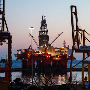
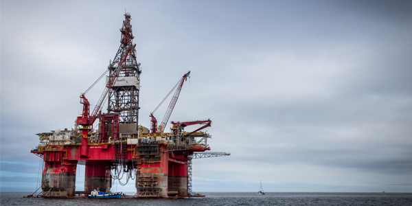
Photos
Some footage of Aru - Tanimbar Basin


Introduction
Preliminary details of Aru - Tanimbar Basin
Data based on:
24 Jan 2023
Exploration History
Detailed history of Aru - Tanimbar Basin
Data based on:
24 Jan 2023
Regional Geology
Detailed regional geology of Aru - Tanimbar Basin
The Tanimbar Basin is a Mesozoic basin that has a graben in a north-northwest-south-southeast direction, bounded by the Moile fault on the southeast side, the Koba-Aru ridge in the Arafura Sea and the Tarera-Aiduna fault in South Irian Jaya to the North. In the southwest, the Tanimbar Basin has a connection to the Malita-Calder graben and continues westward and in the northwest there is a boundary estimated at a bathymetric contour of 1000 meters near the boundary of the oceanic and continental crust.Determination of the age and stratigraphic of Mesozoic rocks in the Tanimbar Islands was obtained from the results of the palynology analysis (Fakhruddin, 2017) and the radiolarian (Jasin and Haile, 1996), as well as the results of research by the Geological Agency in 2015-2017 providing comparisons of different stratigraphic sequences with research earlier.The geological structures found in the Tanimbar Basin can be divided into two, namely: shelf structural features and foldbelt structural features. In the Tanimbar Islands, the developing geological structure is a folding structure that forms an imbricated line of up faults and folds that have displaced rocks that formed on the outer edge of the Australian Continent
Data based on:
24 Jan 2023
Petroleum System
Detailed petroleum system of Aru - Tanimbar Basin
In Tanimbar Island there are two rock formations that are act as source rocks, namely the Selu Formation (Kopai Formation equivalent) and the Bubuan Formation (Piniya Formation equivalent). Based on geochemical data, the TOC value of the Selu Formation is 0.61 - 0.78; while the TOC value of the Bubuan Formation is 0.44 - 0.70. At the Barakan-1 Well, the TOC value of the Selu Formation shows a fair to good (0-32 – 0.75). From the interpretation of 2 seismic line in the direction of the northwest-southeast, there is a possibility of source rock from deposits of Permian – Triassic.Reservoir rocks that can be expected in the Tanimbar Basin are sandstones of the Ungar Formation (Woniwogi Formation equivalent). The porosity of these sandstones ranges from 7-18 % (Texas Union).Based on the petrographic interpretation, these sandstones are divided into three (3), namely; quartz arenite and sublitharenite deposited on the meander river, quartz wacke deposited on the shoreface.The Ungar Formation in the Koba-1 Well is composed of sandstone with siltstone alternating, with negligible porosity (Koesoemadinata, 1980), except at the interval 1.652,5 – 1.655,7 m where the porosity reaches 21%. The thickness of the Ungar Formation at the Koba-1 Well is 131.6m. At the Barakan-1 well, this formation is composed of sandstone and claystone with a thickness of 36.26 m. The sandstone in this well has a porosity ranging from 4 - 16%. No oil or gas was found in the Ungar Formation in both wells.The regional cap rock in the Tanimbar area is the deep marine shale of the Bubuan shale which is equivalent to the Piniya Formation. The spread of this formation is quite thick and wide, developing in the Northwest Australia and southern part of New Guinea. Based on data from the Koba-1 well, the thickness of the Piniya Formation reaches up to 1200 feet.Based on the geological prognosis that has been made, the geology of Tanimbar is generally a block composed of tilted fault structures formed from faults in the northeast-southwest direction and faults in the NNE-SSW direction. From the results of seismic interpretation, the formation of traps observed in the Tanimbar area can be divided into two main trapping systems as follows:• Normal fault closures in sandstones of the Ungar Formation. The geometry of this structure consists of tilted faults, with the faults showing reactivation in the Pliocene.• A potential stratigraphic trap, namely the pinch out of the Ungar Formation sandstones up to the heights of the Tanimbar Block. This stratigraphic trap in the form of a pinchout from a Jurassic formation has been proven by the Tangguh Block gas field in the Bintuni Basin.Lead identification based on several seismic line and the Barakan-1 and Koba-1 wells yielded 10 leads, with a total speculative resource for play gas of 315.43 BCF at P95; 141.94 BCF at P50; and 63.87 BCF at P10
Data based on:
24 Jan 2023
Resources
Detailed resources of Aru - Tanimbar Basin
-
Data based on:
24 Jan 2023
Petroleum System Chart
of
Aru - Tanimbar Basin
Description
Version
-
Published Date
-
Uploaded Date
-
Petroleum System Chart
Petroleum system chart to Aru - Tanimbar Basin
Montage
of
Aru - Tanimbar Basin
Description
Version
1
Published Date
13 Jun 2023
Uploaded Date
13 Jun 2023
Montage
Detailed montage of Aru - Tanimbar Basin
Reports & Publications
of
Aru - Tanimbar Basin
Description
Version
1
Published Date
-
Uploaded Date
20 Jul 2023
Reports & Publications PDF
The PDF displayed is only pages 1 to 20. For a complete PDF, you can download it by clicking the download button.
Archives of Report & Publication
| Date | Report Description | Version | Doc | |
| 01 Nov 2018 | Rekomendasi Wilayah Keprospekan Migas Aru-Tanimbar Offshore | 1 | Download PDF |
| Date | Publication Description | Version | Doc | |
| Oct 03, 2022 | Jurnal Cekungan Aru - Tanimbar Tahun 2022 | 2.0 | Download | |
| Oct 04, 2021 | Jurnal Cekungan Aru - Tanimbar Tahun 2021 | 1.0 | Download | |
| Oct 01, 2020 | Jurnal Cekungan Aru - Tanimbar Tahun 2020 | 2.0 | Download | |
| Oct 05, 2019 | Jurnal Cekungan Aru - Tanimbar Tahun 2019 | 1.0 | Download | |
| Oct 01, 2018 | Jurnal Cekungan Aru - Tanimbar Tahun 2018 | 1.0 | Download | |
| Oct 05, 2017 | Jurnal Cekungan Aru - Tanimbar Tahun 2017 | 1.0 | Download | |
| Oct 04, 2016 | Jurnal Cekungan Aru - Tanimbar Tahun 2016 | 2.0 | Download | |
| Oct 05, 2015 | Jurnal Cekungan Aru - Tanimbar Tahun 2015 | 1.0 | Download | |
| Oct 09, 2014 | Jurnal Cekungan Aru - Tanimbar Tahun 2014 | 2.0 | Download | |
| Oct 09, 2013 | Jurnal Cekungan Aru - Tanimbar Tahun 2013 | 1.0 | Download | |
| Oct 04, 2012 | Jurnal Cekungan Aru - Tanimbar Tahun 2012 | 2.0 | Download |