Producing Basin
Basin Status
Rifting Valley Passive Margin
Tectonic Setting
0
Area (km2)
0
Visitor Count
0
Likes
Executive Summary
of
Banggai Basin
Description
Version
1
Published Date
20 Jan 2023
Uploaded Date
-
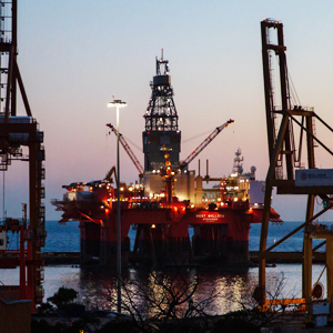
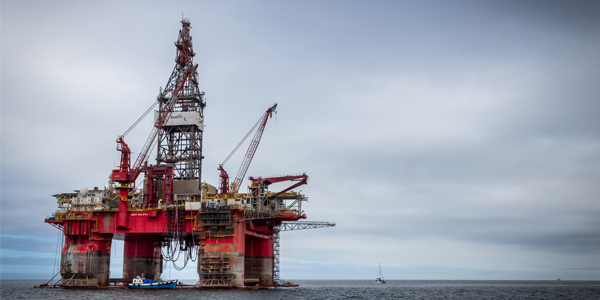
Photos
Some footage of Banggai Basin


Introduction
Preliminary details of Banggai Basin
The investigation about petroleum system was conducted in Balantak area that took place in the Banggai Basin. Administratively, the Balantak Oil and Gas Prospect Area is included in Banggai Regency, Central Sulawesi Province. Within the regional tectonic framework, the Balantak region is part of Banggai-Sula micro-continent (Surjono, 2011)
Data based on:
20 Jan 2023
Exploration History
Detailed history of Banggai Basin
Data based on:
20 Jan 2023
Regional Geology
Detailed regional geology of Banggai Basin
In general, the Banggai-Sula micro-continent is bounded by the Batui Fault at the northwest end, the Balantak fault on the east-northeast side and the Sorong fault on the south-southwest part. The location of the Balantak Region is strongly influenced by the Batui reverse fault which was formed as a result of the collision of the Banggai-Sula micro-continent with the East Sulawesi Ophiolite Belt. The stratigraphy of the Balantak Region is underlain by Limestone-marls Jurassic Nambo Formation. This formation is exposed to a limited extent in the Nambo area. The Ophiolite complex is widely distributed in the study area and was formed in a curved pattern with Northeast-Southwest direction. The Matano Formation or the Luok Formation consists of Late Cretaceous marl and chert limestone found extending almost west–east trend with the main outcrops in the Balantak, Salodik and Pagimana areas. The distribution of Mesozoic rocks is of particular interest because it gives hope for the existence of a remaining petroleum system in Mesozoic rocks. The Eocene-Oligocene Salodik group is composed of limestone with shale intercalation. Shale in the Salodik Formation is a good source rock in the Senoro-Donggi Gas Field and the Tiaka Oil Field. The Poh Formation is composed of Oligocene-Miocene marl and is contiguous with the Salodik Formation. The Miocene-Pliocene Kintom Formation in the form of conglomerates was found out of alignment above the Poh Formation. The Kintom Formation is a synorogenic deposit. Lonsio volcanic rocks of Miocene-Pliocene age were found around the Pangkalaseang area. It is suspected that this volcanic rock was deposited in the back of the arc. The youngest rocks are alluvium (Qa) and reef limestone (Ql) which are still growing. The results of measurements of the geological structure in the form of bedding planes, fissures, faults and joints in Pra-Tertiary aged rocks show that there was a stress that has west-northwest-east-southeast trend which associated with the movement of the Banggai-Sula micro-continent when it is detached from the Australian continent. The results of field measurements on Tertiary rocks in the form of joints, faults, and bedding planes show that there is compression mainly northwest-southeast to northeast-southwest in trend. This occurs because there is a change of the fault regime during the collision to the horizontal fault regime of the Balantak fault after the collision. The diagram of igneous geochemical analysis results from micro gabbro samples and four basal samples of the Lonsio Formation (Late Miocene-Pliocene) shows that there is a mild decrease in REE values, especially Nb and La elements, indicating the magma originating from island arcs associated with subduction. In the heavy element section there is an enrichment of the element Lu, which is interpreted as coming from the mineral garnet. This shows that the rock contains minerals resulting from garnet smelting. The results of petrography observations indicate that there are several possible porosities in the form of channel traces of stylolite dissolution, joints, intraclass dissolution, groundmass dissolution, and vuggy generation. On the Bouguer Anomaly Map and the Regional Anomaly Map it appears that the distribution of ophiolite rocks is characterized by a low anomaly. This is not normal, so it can be interpreted that under the ophiolite there is still thick Mesozoic sedimentary rock. The Banggai Archipelago and its surroundings show high anomalies associated with the Banggai Sula micro-continent, while the anomaly in the northern part of the island (Pangkalasesang) to Ampana is associated with the distribution of volcanic rocks. The remaining blue anomaly indicates the kitchen area. Area that are red to purple at the edges make good reservoirs.
Data based on:
20 Jan 2023
Petroleum System
Detailed petroleum system of Banggai Basin
The petroleum system in the Balantak Basin are the source rock consists of shale, sandstone and coal intercalations which are found at intervals of 7120-7300 ft and 9820-9970 ft, generally having a richness of organic material which is dominated by sufficient quantity (TOC amount around 0.68 to 0.89 percent). Primary reservoir rocks consist of Early Miocene limestone of Tomori Formation, Middle-Late Miocene limestone of Minahaki Formation and reef limestones belonging to Mentawai Formation. Secondary reservoir rocks are Jurassic shallow marine sandstones, secondary porosity in ophiolite, metamorphic, and Paleozoic granite like fractures. The results of the porosity analysis in the Matano Formation and the Salodik Formation were compared with the porosity results from Pertamina BPPKA (1996). The cap rocks in the Banggai Basin, especially in the Senoro field, are Pliocene shales of the Kintom Formation deposited in a batial marine environment which are the result of sedimentation syn-orogenic deposits covering Miocene reservoir rocks. Apart from the Kintom Formation, isolated rocks intercalation are also found in Miocene carbonate rocks (Middle Miocene Matindok Formation Shales) which are the cap rocks in the Tiaka Field. There are three main plays in the Balantak Region (Pertamina BPPKA, 1996) such as carbonate build-up, horizontal fault and reverse fault.
Data based on:
20 Jan 2023
Resources
Detailed resources of Banggai Basin
-
Data based on:
20 Jan 2023
Petroleum System Chart
of
Banggai Basin
Description
Version
1
Published Date
20 Jun 2023
Uploaded Date
20 Jun 2023
Petroleum System Chart
Petroleum system chart to Banggai Basin
Montage
of
Banggai Basin
Description
Version
-
Published Date
-
Uploaded Date
-
Montage
Detailed montage of Banggai Basin
Reports & Publications
of
Banggai Basin
Description
Version
1
Published Date
-
Uploaded Date
20 Jul 2023
Reports & Publications PDF
The PDF displayed is only pages 1 to 20. For a complete PDF, you can download it by clicking the download button.
Archives of Report & Publication
| Date | Report Description | Version | Doc | |
| 01 Dec 2016 | Rekomendasi Wilayah Keprospekan Migas Balantak | 1 | Download PDF |
| Date | Publication Description | Version | Doc | |
| Oct 05, 2022 | Jurnal Cekungan Banggai Tahun 2022 | 2.0 | Download | |
| Oct 02, 2021 | Jurnal Cekungan Banggai Tahun 2021 | 2.0 | Download | |
| Oct 07, 2020 | Jurnal Cekungan Banggai Tahun 2020 | 2.0 | Download | |
| Oct 08, 2019 | Jurnal Cekungan Banggai Tahun 2019 | 1.0 | Download | |
| Oct 05, 2018 | Jurnal Cekungan Banggai Tahun 2018 | 2.0 | Download | |
| Oct 04, 2017 | Jurnal Cekungan Banggai Tahun 2017 | 1.0 | Download | |
| Oct 07, 2016 | Jurnal Cekungan Banggai Tahun 2016 | 1.0 | Download | |
| Oct 09, 2015 | Jurnal Cekungan Banggai Tahun 2015 | 2.0 | Download | |
| Oct 06, 2014 | Jurnal Cekungan Banggai Tahun 2014 | 2.0 | Download | |
| Oct 08, 2013 | Jurnal Cekungan Banggai Tahun 2013 | 2.0 | Download | |
| Oct 05, 2012 | Jurnal Cekungan Banggai Tahun 2012 | 1.0 | Download |