Ditapis dengan

Integration of GIS and Remote Sensing
Integration of GIS and Remote Sensing explores the tremendous potential that lies along the interface between GIS and remote sensing for activating interoperable databases and instigating information interchange.it concentrates on the rigorous and maticulous aspects analytical data matching and thematic compatibility-the true roots of all branches of GIS/remote sensing applications .however ,cl…
- Edisi
- -
- ISBN/ISSN
- 978-0-470-86409-8
- Deskripsi Fisik
- xvi, 296 hlm. : ilus. ; 23 cm.
- Judul Seri
- Mastering GIS : Technology, Applications And Management
- No. Panggil
- 910.285 MES i

Remote Sensing and Image Interpretation : Third Edition
This book is primarily for use in introductory courses in remote sensing and image interpretation. Given the many diverse apllications of remote sensing, courses on the subject appeal to students having a wide range of academic backgrounds and interests. We have written this book in anticipation of the variety of settings in which remote sensing might be used and have made this discussion “di…
- Edisi
- -
- ISBN/ISSN
- 978-0-470-05245-7
- Deskripsi Fisik
- 737 hal.;gbr.
- Judul Seri
- -
- No. Panggil
- PVG 612.367 LIL r c.1

Manual of Remote Sensing
In the broadest sense, remote sensing encompasses the total observational process from remote platforms, It typically entails the use at a distance (as from aircraft, spacecraft or ship) of any system for gathering information pertinent to the environment.
- Edisi
- -
- ISBN/ISSN
- 0-937294-X
- Deskripsi Fisik
- 2417 hal.; gbr.;
- Judul Seri
- -
- No. Panggil
- PVG 621.367 COL (1) M c.1

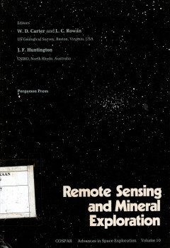
Remote Sensing and Mineral Exploration
As editors of this volume, we wish to take this opportunity to thank COSPAR, the Indian National Organizing Committee of COSPAR, the Indian Space Research Organization, the Geological Survey of India and, most of all, the participants of the Workshop on Remote Sensing and Mineral Exploration for making the workshop a success.
- Edisi
- -
- ISBN/ISSN
- 0-08-024438-6
- Deskripsi Fisik
- 173 hlm.; gbr
- Judul Seri
- -
- No. Panggil
- PVG 621.367 CAR r c.1

Remote Sensing ; Principles and Interpretation
In recent years, temote sensing technology has undergone dramatic changes and these changes are reflected in its significant impact on diverse fields. Nowhere ae these advances conveyed more clearly or effectively than in the third edition of Floyd F. Sabins’s Remote Sensing : Principles and Interpretation. This widely acclaimed text has been thorougly update it contains 50 precent new materi…
- Edisi
- -
- ISBN/ISSN
- 0-7167-2442-1
- Deskripsi Fisik
- 485 hal.; gbr., foto.
- Judul Seri
- -
- No. Panggil
- PVG 621.367 SAB R c.1

Remote Sensing of The Environment ; An Earth Resource Perspective
The book introduces the principles of visual photo-interpretation and image analysis. It is companion volume to Introductory Digital Image Processing : A Remote Sensing Perspective (2005) Published by Peason Education, Inc., which introduces the fundamentals of digital image analysis.
- Edisi
- -
- ISBN/ISSN
- 0-13-188950-8
- Deskripsi Fisik
- , 583 hal.; gbr.; lamp.; tabel.
- Judul Seri
- -
- No. Panggil
- PVG 621.367 JEN R c.1

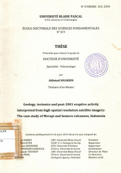
Geology,tectonics and post-2001 eruptive activity interpreted from high-spati…
Penginderaan jauh telah lama dikenal sebagau suatu alat untuk analisis di gunungapi aktif dan berbahaya karena dapat meningkatkan pemahaman kita tentang proses yang mendasari aktivitas gunung berapi sehingga memungkinkan kita untuk menerapkan pemahaman ini dalam pengurangan risiko erupsi gunungapi. Disertasi ini menyajikan studi vulkanologi menggunakan citra satelit optik resolusi tinggi (IKINO…
- Edisi
- -
- ISBN/ISSN
- -
- Deskripsi Fisik
- 229 hal,; gbr.; lamp.; tabel.
- Judul Seri
- -
- No. Panggil
- PVG (043)551.21(E2) SOL g c.1

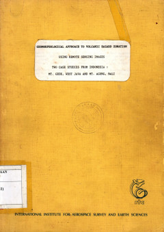
Geomorfological Approach to Volcanic Hazard Zonation ; Using Remote Sensing I…
This thesis concered with volcanic hazard and risk. The study was addressed to analyzed and mapping of volcanic landform, mapping of volcanic hazard and volcanic risk zones of the area by yusing an aid of aerial photograph and other remote sensing image. Geomorphological approach have been used for analysing the landform wich is relatide to the volcanic hazard and its risk.
- Edisi
- -
- ISBN/ISSN
- -
- Deskripsi Fisik
- 94 hal.; tabel; figure; maps.
- Judul Seri
- -
- No. Panggil
- PVG (043)550.816 BAC g c.1

REMOTE SENSING FOR GEOSCIENTISTS : Image Analysis and Integration, Third Edition
- Edisi
- -
- ISBN/ISSN
- -
- Deskripsi Fisik
- 25 x 17cm., xix, 674hal.,gam.,index
- Judul Seri
- Textbook (BUKU)
- No. Panggil
- PAG 550.816 PRO
- Edisi
- -
- ISBN/ISSN
- -
- Deskripsi Fisik
- 25 x 17cm., xix, 674hal.,gam.,index
- Judul Seri
- Textbook (BUKU)
- No. Panggil
- PAG 550.816 PRO

Research Methods in Remote Sensing
- Edisi
- -
- ISBN/ISSN
- -
- Deskripsi Fisik
- xii + 125 hal; 23 x 15.5 cm; index + tabel
- Judul Seri
- Textbook (BUKU)
- No. Panggil
- PAG 621.398 BHA
- Edisi
- -
- ISBN/ISSN
- -
- Deskripsi Fisik
- xii + 125 hal; 23 x 15.5 cm; index + tabel
- Judul Seri
- Textbook (BUKU)
- No. Panggil
- PAG 621.398 BHA
 Karya Umum
  Filsafat
  Agama
Agama  Ilmu-ilmu Sosial
  Bahasa
  Ilmu-ilmu Murni
  Ilmu-ilmu Terapan
  Kesenian, Hiburan, dan Olahraga
  Kesusastraan
  Geografi dan Sejarah