Ditapis dengan

Indonesian Heritage Amazing Stories of Provinces Jakarta: My First Cartoonal …
- Edisi
- -
- ISBN/ISSN
- 978-979-3973-75-3
- Deskripsi Fisik
- 39 hlm.
- Judul Seri
- -
- No. Panggil
- PSG 347.66(910)(03) SUN i
- Edisi
- -
- ISBN/ISSN
- 978-979-3973-75-3
- Deskripsi Fisik
- 39 hlm.
- Judul Seri
- -
- No. Panggil
- PSG 347.66(910)(03) SUN i

1001 Ways to Save the Earth
- Edisi
- -
- ISBN/ISSN
- 978-0-8118-5986-8
- Deskripsi Fisik
- 384 hlm.
- Judul Seri
- -
- No. Panggil
- PSG 55 YAR s
- Edisi
- -
- ISBN/ISSN
- 978-0-8118-5986-8
- Deskripsi Fisik
- 384 hlm.
- Judul Seri
- -
- No. Panggil
- PSG 55 YAR s

Active Earth
- Edisi
- -
- ISBN/ISSN
- 978-1-78209-636-8
- Deskripsi Fisik
- 40 hlm.
- Judul Seri
- -
- No. Panggil
- PSG 55 BED a
- Edisi
- -
- ISBN/ISSN
- 978-1-78209-636-8
- Deskripsi Fisik
- 40 hlm.
- Judul Seri
- -
- No. Panggil
- PSG 55 BED a

Be Yourself, Frog. Activities. Story Telling: Art. Science. My First Augmente…
- Edisi
- -
- ISBN/ISSN
- -
- Deskripsi Fisik
- 130 hlm.
- Judul Seri
- -
- No. Panggil
- PSG (I)347.66 BEY b
- Edisi
- -
- ISBN/ISSN
- -
- Deskripsi Fisik
- 130 hlm.
- Judul Seri
- -
- No. Panggil
- PSG (I)347.66 BEY b

Computational Earthquake Physics : Simulations, Analysis and Infrastructure P…
Exciting developments in earthquake science have benefited from new observations, improved computational technologies, and improved modelling capabilities. Designing realistic supercomputer simulation models for the complete earthquake generation process is a grand scientific challenge due to the complexity of phenomena and range of scales involved from microscopic to global.
- Edisi
- -
- ISBN/ISSN
- 3-7643-79991-X
- Deskripsi Fisik
- 2031 hlm.; gbr.
- Judul Seri
- -
- No. Panggil
- PVG 618.3 YIN c c.1

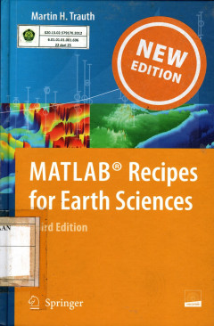
Matlab : Recipes for Earth Sciences
Matlab is used for for a wide range of applications in geosciences, such as image processing in remote sensing, the generation and processing of digital elevation models, and the analysis of time series. This book introduce methods of data analysis in geosciences using Matlab, such as basic statistics for univariate, bivariate and multivariate datasets, time-series analysis, signal processing, …
- Edisi
- -
- ISBN/ISSN
- 978-3-642-12761-8
- Deskripsi Fisik
- 327 hlm.; gbr.
- Judul Seri
- -
- No. Panggil
- PVG 681.3 TRA m C.1

Volcanoes & Earthquakes Geologic Violence
The most fundamental part of our environment is the earth on which we live and with which we have the closest contact. This is the realm of geology, the science of the earth. The materials of the solid earth – the rocks, their structure, their alteration by geologic processes, the fossil remains of ancient life in the rock formations – these are the tools the geologist uses to reconstruct t…
- Edisi
- -
- ISBN/ISSN
- 0-07-047492-3
- Deskripsi Fisik
- 129 hal.; gbr.; tabel.
- Judul Seri
- -
- No. Panggil
- PVG 551.21 Oak v c.1

Instrumentation in Earthquake Seismology
Seismology would be a very different science without instruments. The real big advance in seismology happened form around 1900 and onwards and was mainly due to advancement in making better seismograph (more sensitive) and devising timing system so earthquakes could be located.
- Edisi
- -
- ISBN/ISSN
- -
- Deskripsi Fisik
- 256 hlm.; gbr.
- Judul Seri
- -
- No. Panggil
- PVG 551.22 HAV i C.1

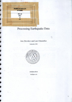
Processing Earthquake Data
The purpose of this book is to get a practical understanding of the most common processing techniques in earthquake seismology. The book will deal with manual methods and computer assisted methods. The idea is that each topic will be introduced with the basic theory followed by practical examples and exercises.
- Edisi
- -
- ISBN/ISSN
- -
- Deskripsi Fisik
- 191 hlm.; gbr.
- Judul Seri
- -
- No. Panggil
- PVG 551.22 HAV p C.1

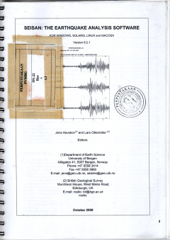
Seisan: The Earthquake Analysis Software for Windows, Solaris, Linux and Macosx
The seisan seismic analysis system is a complete set of programs and a simple database for analyzing earthquakes from analog and digital data. With Seisan it is possible using local and global earthquakes to enter phase readings manually or pick them with a cursor, locate events, edit events, determine spectral parameters, seismic moment, azimuth or arrival from 3-componenr stations and plot ep…
- Edisi
- -
- ISBN/ISSN
- -
- Deskripsi Fisik
- 267 hlm.; gbr.
- Judul Seri
- -
- No. Panggil
- PVG 551.22 HAV s C.1
 Karya Umum
  Filsafat
  Agama
Agama  Ilmu-ilmu Sosial
  Bahasa
  Ilmu-ilmu Murni
  Ilmu-ilmu Terapan
  Kesenian, Hiburan, dan Olahraga
  Kesusastraan
  Geografi dan Sejarah