Ditapis dengan

Paparan Bimbingan G. Api Di G. Ijen Kec. Perwakilan Sempol Kab. Bondowoso dan…
Gunungapi Ijen adalah gunungapi raksasa (Pra Kaldera), bertipe strato dengan ketinggian l.k. 3.500 m dari muka air laut, yang dinamakan Ijen Tua, pembentukan kaldera Ijen terjadi kira - kira pada 50.000 tahun yang lalu, dengan rempah vulkanik sebanyak 80 km3 tersebar di sekelilingnya berupa endapan awan panas, batuan piroklastika jatuhan serta aliran.
- Edisi
- -
- ISBN/ISSN
- -
- Deskripsi Fisik
- 78 hlm
- Judul Seri
- -
- No. Panggil
- PVG E.94-45

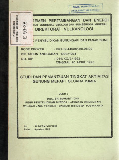
Studi dan Pemantauan Tingkat Aktivitas G. Merapi, Secara Kimia
Untuk memperkecil bencana akibat kegiatan Gunung Merapi yang teramati sejak 20 Januari 1993 dan hingga kini masih berlangsung, telah dilakukan penyelidikan dan pemantauan aktivitas Gunung Merapi secara terus menerus dan berkala.
- Edisi
- -
- ISBN/ISSN
- -
- Deskripsi Fisik
- 24 hlm
- Judul Seri
- -
- No. Panggil
- PVG E.93-28

Penyelidikan Kegempaan dan Kemagnetan G. Merapi Serta Hubungannya Dengan Emis…
Dalam mengantisispasi perkembangan aktifitas G.Merapi terutama setelah aktifitas G. Merapi menjadi aktif normal, maka pada bulan Agustus diadakan penyelidikan dan pengamatan, terutama untuk mengikuti perkembangan gempa LF dan gempa vulkanik.
- Edisi
- -
- ISBN/ISSN
- -
- Deskripsi Fisik
- 26 hlm
- Judul Seri
- -
- No. Panggil
- PVG E.93-29

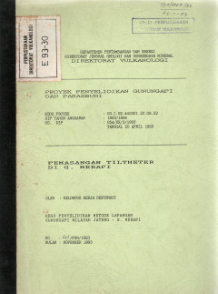
Pemasangan Tiltmeter Di G. Merapi
Metoda deformasi sejak dua tahun terakhir ini diterapkan secara intensif sebagai metode monitoring di G.Merapi, yaitu dengan penerapan beberapa teknik pengukuran, seperti pengukuran EDM sejak 1988, tiltmeter, ekstensometer, dan GPS (Global Positioning Systems).
- Edisi
- -
- ISBN/ISSN
- -
- Deskripsi Fisik
- 18 hlm
- Judul Seri
- -
- No. Panggil
- PVG E.93-30

Penyelidikan Gas, Air, Udara Dalam Tanah, Temperatur dan Kecepatan Emisi Gas …
Gunung Merapi merupakan salah satu Gunungapi paling aktif di Indonesia yang dipantau secara terus menerus menggunakan berbagai metoda pemantauan karena mempunyai derajat bahaya yang tinggi.
- Edisi
- -
- ISBN/ISSN
- -
- Deskripsi Fisik
- 24 hlm
- Judul Seri
- -
- No. Panggil
- PVG E.93-31

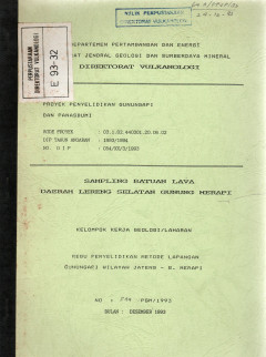
Sampling Batuan Lava Daerah Lereng Selatan Gunung Merapi
Pada triwulan ketiga tahun anggaran 1993 - 1994, Kelompok Kerja Geologi dan Laharan melakukan sampling batuan untuk kelengkapan data petrologi/geokimia batuan G.Merapi, khususnya pada jenjang selatan
- Edisi
- -
- ISBN/ISSN
- -
- Deskripsi Fisik
- 9 hlm
- Judul Seri
- -
- No. Panggil
- PVG E.93-32

Penyelidikan Pengaruh Gempa Tektonik Terhadap Aktivitas G. Merapi
Kelompok Kerja Seismik/Magnetik pada kesempatan ini mencoba menganalisa pengaruh gempa bumi (gempa tektonik) terhadap aktivitas gunungapi Merapi. Mekanisme gempa tektonik karena perubahan posisi massa batuan di dalam kerak bumi secara serentak. Dengan perubahan posisi massa batuan itu apakah dapat mempengaruhi aktivitas gunung (Merapi) atau tidak.
- Edisi
- -
- ISBN/ISSN
- -
- Deskripsi Fisik
- 21 hlm
- Judul Seri
- -
- No. Panggil
- PVG E.93-33

Ujicoba Sistem Telemetri Seismik Di G. Guntur Dengan Seismometer Hosaka Sebag…
Penyelidikan kegiatan suatu gunungapi dengan metoda seismik, sampai saat ini merupakan metoda yang dapat dianggap paling tua, fundamental, dan terampuh daripada metoda lain. Peralatan, baik software maupun hardwarenya yang digunakan untuk metoda ini berkembang terus sesuai dengan perkembangan teknologi yang ada.
- Edisi
- -
- ISBN/ISSN
- -
- Deskripsi Fisik
- 7 hlm
- Judul Seri
- -
- No. Panggil
- PVG E.93-34

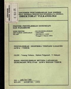
Penyelidikan Geofisika Terpadu G. Raung Jawa Timur
Dalam rangka memonitor kegiatan G. Raung, secara kontinyu dilakukan pengamatan kegempaannya dari pos G. Raung . Rambat gelombang gempa akibat adanya magma naik yang menyebabkan retakan - retakan pada batuan yang dilewati, dicatat dalam bentuk grafik yang menunjukkan besar & kecilnya aktivitas dari dalam gunungapi tersebut.
- Edisi
- -
- ISBN/ISSN
- -
- Deskripsi Fisik
- 34 hlm
- Judul Seri
- -
- No. Panggil
- PVG E.93-35

Pengukuran dan Ujicoba GPS Di G. Raung Jawa Timur
Dalam rangka program penelitian terpadu yang dilakukan oleh Subdirektorat Analisa Gunungapi, telah dilakukan pengukuran parameter - parameter geofisika yaitu gravity, geomaknit, ungkit dan SP (Self Potential). Lokasi pengukuran adalah di G.Raung. Pada waktu yang bersamaan dilakukan pula pengecekan posisi beberapa titik pengukuran pada lintasan yang dilakukan oleh team dengan menggunakan Penerim…
- Edisi
- -
- ISBN/ISSN
- -
- Deskripsi Fisik
- 5 hlm
- Judul Seri
- -
- No. Panggil
- PVG E.93-36
 Karya Umum
  Filsafat
  Agama
Agama  Ilmu-ilmu Sosial
  Bahasa
  Ilmu-ilmu Murni
  Ilmu-ilmu Terapan
  Kesenian, Hiburan, dan Olahraga
  Kesusastraan
  Geografi dan Sejarah