Ditapis dengan
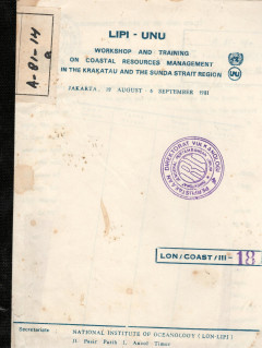
Oceanographic Feature of The Sunda Strait
The Sunda Strait is situated between the island of Java and Sumatra, connecting the Java Sea in the north and the Indian Ocean in the South. In the northern part the strait is narrower and shallower than in the southern part. The narrowest part in the north is only about 24 km wide with depth of less than 8 m.
- Edisi
- -
- ISBN/ISSN
- -
- Deskripsi Fisik
- 43 hlm; gmbr; peta
- Judul Seri
- -
- No. Panggil
- PVG A.81-14

Laporan Kegiatan Perbaikan dan Kalibrasi peralatan Seismograph di Gunung Tang…
Untuk mendapatkan hasil rekaman berupa data kegiatan Seismik gunungapi yang baik diperlukan pengecekan/perbaikan dan kalibrasi kembali pada semua peralatan seismograph yang dipakai disekitar gurunungapi tersebut.
- Edisi
- -
- ISBN/ISSN
- -
- Deskripsi Fisik
- 4 hlm.
- Judul Seri
- -
- No. Panggil
- PVG E.86-31

Laporan Perbaikan dan Kalibrasi Peralatan Seismograph Di Gunung Merapi dan Gu…
Pengecekan dan kalibrasi ini sangat perlu diadakan mengingat sebagian besar dari peralatan seismograph itu terdiri dari peralatan yang menggunakan component elektronika yang sering dapat berubah karakteristiknya akibat panas yang disebabkan oleh lamanya pemakaian yang terus menerus, sebab gangguan cuaca atau bisa juga berubah yang disebabkan oleh menurunnya tegangan power (batere).
- Edisi
- -
- ISBN/ISSN
- -
- Deskripsi Fisik
- 7 hlm
- Judul Seri
- -
- No. Panggil
- PVG E.85-76

Topographic Reconnaissance Survey Of Galunggung Cone, March 14, 1983
The topographic reconnaissance survey was carried out by us in March 15, 1983. The survey has utilized the modest available equipment for surveying, e.i. magnetic geologic compass and range finder. Altimeter was also used to determine the elevation. The survey was done in the morning between 7.00 to 8.00 am.
- Edisi
- -
- ISBN/ISSN
- -
- Deskripsi Fisik
- 3 hlm;gmbr
- Judul Seri
- -
- No. Panggil
- PVG E.83-7
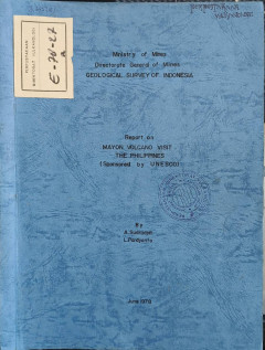
Report On Mayon Volcano Visit The Philipines.
An invitation issued by Unesco under the Volcanologist Exchange Programme has given opportunity to the authors to visit Mayon Volcano, South Luzon, The Philippines, which was reported to have shown an increasing activity early May this year. The first increasing volcanic phenomenon was observed on May 3, and harmonic tremors were recorded the following days. The precaution measures have then be…
- Edisi
- -
- ISBN/ISSN
- -
- Deskripsi Fisik
- 17 hlm
- Judul Seri
- -
- No. Panggil
- PVG E.78-27

The Eruptive Activities and Associated Phenomena Of Mt. Merapi (C - Java) Dur…
During the month of January the growth of lava dome continued slowly. From time to time at night glares above the dome could be observed. On January 15 a lava avalanche entered the upper course of R. Batang. In February the growth of lava dome seemed to cease completely.
- Edisi
- -
- ISBN/ISSN
- -
- Deskripsi Fisik
- 9 hlm
- Judul Seri
- -
- No. Panggil
- PVG E.75-3

Setu Patok, Cirebon, West Java, Indonesia A Phreato-Magmatic Eruption Center …
The purpose of this report is to indicate the exixtence of a phreato-magnetic volcanic center in the densely populated area south of Cirebon city. On July 6 and July 29, 1988, I examined the geology of the area near the reservoir (waduk) Setu Patok , located 8 km south of Cirebon city (Figure 1) [108 degrees, 47', 10" S; topographic map, 1966 series, sheet 4722 IV, Tjirebon].
- Edisi
- -
- ISBN/ISSN
- -
- Deskripsi Fisik
- 14hlm; gbr; peta
- Judul Seri
- -
- No. Panggil
- PVG E.88-16

Report general investigation of rare earth element utilizing geological, geoc…
- Edisi
- -
- ISBN/ISSN
- -
- Deskripsi Fisik
- 184p.: ill; 21 x 30 cm
- Judul Seri
- -
- No. Panggil
- 553.49 SUL r
- Edisi
- -
- ISBN/ISSN
- -
- Deskripsi Fisik
- 184p.: ill; 21 x 30 cm
- Judul Seri
- -
- No. Panggil
- 553.49 SUL r

Integration of GIS and Remote Sensing
Integration of GIS and Remote Sensing explores the tremendous potential that lies along the interface between GIS and remote sensing for activating interoperable databases and instigating information interchange.it concentrates on the rigorous and maticulous aspects analytical data matching and thematic compatibility-the true roots of all branches of GIS/remote sensing applications .however ,cl…
- Edisi
- -
- ISBN/ISSN
- 978-0-470-86409-8
- Deskripsi Fisik
- xvi, 296 hlm. : ilus. ; 23 cm.
- Judul Seri
- Mastering GIS : Technology, Applications And Management
- No. Panggil
- 910.285 MES i
A Government Of New Zealand Aid Project With The Government Of Indonesia Geot…
- Edisi
- -
- ISBN/ISSN
- -
- Deskripsi Fisik
- 95 Halaman, Tanpa Warna, Cover Biru, Tanpa Peta
- Judul Seri
- -
- No. Panggil
- PMB LE 1968 - 11 NL
- Edisi
- -
- ISBN/ISSN
- -
- Deskripsi Fisik
- 95 Halaman, Tanpa Warna, Cover Biru, Tanpa Peta
- Judul Seri
- -
- No. Panggil
- PMB LE 1968 - 11 NL
 Karya Umum
  Filsafat
  Agama
Agama  Ilmu-ilmu Sosial
  Bahasa
  Ilmu-ilmu Murni
  Ilmu-ilmu Terapan
  Kesenian, Hiburan, dan Olahraga
  Kesusastraan
  Geografi dan Sejarah