Ditapis dengan
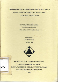
Deformasi Gunung Guntur Berdasarkan Data Pengamatan GPS Kontinyu (Januari - J…
Pada prinsipnya deformasi dari tubuh gunungapi dapat berupa kenaikan permukaan tanah (inflasi) ataupun penurunan permukaan tanah (deflasi). Deformasi yang berupa inflasi umumnya terjadi karena proses gerakan magma ke permukaan yang menekan permukaan tanah di atasnya.
- Edisi
- -
- ISBN/ISSN
- -
- Deskripsi Fisik
- 54 hal,; gbr.; lamp.; tabel.
- Judul Seri
- -
- No. Panggil
- PVG L.18-29 (KP)
Arcgis 9 : Geoprocessing in ArcGIS
eoprocessing is the processing of geographic information, on the most basic funcions of a geographic information sytem (GIS). Within any of the ESRI Arcgis Desktop product ArcInfo, ArcEditor, and ArcView. You can perform geoprocessing task on your data. Geoprocessing provides a way to create new information by processing exiting data. Any alteration or information extraction performed on data i…
- Edisi
- -
- ISBN/ISSN
- 1-58948-092-9
- Deskripsi Fisik
- 357p,.ill. 22 x 19 cm
- Judul Seri
- -
- No. Panggil
- 055.5 ILL a
ArcGIS 9 : Getting started with arcgis
This self-study workbook is a hands-on introduction to geographic information system (GIS) software using the ESRI Arcgis Desktop product-Arcinfo, ArcEditor, and Arciew. A Gis is a computer based system for collecting, storing, managing, analyzing, and presenting geographic information. In this book, you'II plan and conduct a GIS analysis project with the applications found in Arcgis desktop.
- Edisi
- -
- ISBN/ISSN
- 1-58948-091-0
- Deskripsi Fisik
- 262p,.ill. 22 x 19 cm
- Judul Seri
- -
- No. Panggil
- 005.5 OTT a
ArcGIS 9 : what is Arcgis 9.1?
ArcGIS software is a comprehensive, integrated, scaleable system for implementing a geographic information system (GIS) for a single user or for many user on desktop, in sercer, over the web, and in the field. It consist of a number of frameworks for deploying GIS including. what is arcGIS 9.1? discusses the various parts of Arcgis and the role each part plays in a GIS, as well as taking a clos…
- Edisi
- -
- ISBN/ISSN
- 1-58948-132-1
- Deskripsi Fisik
- 119p,.ill. 22 x 19 cm
- Judul Seri
- -
- No. Panggil
- 005.5 SRI a
ArcGIS 9 : Using arcgis desktop
ArcGIS desktop lets you perform the full range of GIS task-from geodatabase design and management to data editing, from map query to cartographic production and sophisticated geographic visualization and anaysis. It is where the core work of GIS occurs. This book gives you an overview of the ArcGIS Desktop system and shows you how to access the basic funcions of the software.
- Edisi
- -
- ISBN/ISSN
- 978-1-58948-167-1
- Deskripsi Fisik
- 419p,.ill. 22 x 19 cm
- Judul Seri
- -
- No. Panggil
- 005.5 SRI a

Buletin sumber daya geologi volume 12 no 1, Mei 2017
- Edisi
- 12th vol
- ISBN/ISSN
- 1907-5367 / eISSN: 2
- Deskripsi Fisik
- 70p. : ill. ; 21 cm
- Judul Seri
- -
- No. Panggil
- PMB volume 12 no 1, Mei 2017
 Karya Umum
  Filsafat
  Agama
Agama  Ilmu-ilmu Sosial
  Bahasa
  Ilmu-ilmu Murni
  Ilmu-ilmu Terapan
  Kesenian, Hiburan, dan Olahraga
  Kesusastraan
  Geografi dan Sejarah