Ditapis dengan

Jozef zwierzycki, A Geologist of the Indonesian Archipelago and Poland
- Edisi
- -
- ISBN/ISSN
- -
- Deskripsi Fisik
- 40p.: ill; 21 x 30 cm
- Judul Seri
- -
- No. Panggil
- 550.92 ITB j
- Edisi
- -
- ISBN/ISSN
- -
- Deskripsi Fisik
- 40p.: ill; 21 x 30 cm
- Judul Seri
- -
- No. Panggil
- 550.92 ITB j

Integration of GIS and Remote Sensing
Integration of GIS and Remote Sensing explores the tremendous potential that lies along the interface between GIS and remote sensing for activating interoperable databases and instigating information interchange.it concentrates on the rigorous and maticulous aspects analytical data matching and thematic compatibility-the true roots of all branches of GIS/remote sensing applications .however ,cl…
- Edisi
- -
- ISBN/ISSN
- 978-0-470-86409-8
- Deskripsi Fisik
- xvi, 296 hlm. : ilus. ; 23 cm.
- Judul Seri
- Mastering GIS : Technology, Applications And Management
- No. Panggil
- 910.285 MES i

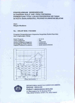
Penyelidikan Hidrogeologi di Daerah Sulit Air / Desa Tertinggal Penentuan Tit…
Berdasarkan hasil penyelidikan, disimpulkan lokasi daerah penelitian merupakan daerah sulit air. Lokasi Warga RT.39-RW.01 Sungai Samba dan Pondok Pesantren Nurul Ma'ad berturut-turut berlevasi kurang lebih 8,0 maml dan 5 maml, menempati daerah dataran rendah yang merupakan daerah lepasan air tanah. Secara geologi dua desa ini ditutupi oleh aluvium berupa endapan sungai dan rawa yang terdiri ata…
- Edisi
- -
- ISBN/ISSN
- -
- Deskripsi Fisik
- iii, 44 hlm.:ill;gbr;tab;lamp
- Judul Seri
- -
- No. Panggil
- PAG L2025-137

Pengembangan Skenario Untuk Rencana Kontinjensi Unit 2 ; Menganalisis Data de…
Peta gratis dan kolaboratif mempunyai keunikan yang berharga untuk pekerjaan kemanusiaan, terutama di tempat-tempat dimana peta dasar sangat jarang ditemukan, datanya sudah lama, atau seringkali berubah. Dibangun dalam dua tahun dari kolaborasi secara informal. Tim Kemanusiaan OpenStreetMap merupakan sebuah inisiatif yang baru untuk mengaplikasikan prinsip dan aktifitas dari sumber terbuka dan …
- Edisi
- -
- ISBN/ISSN
- -
- Deskripsi Fisik
- 125 hal.; gbr.
- Judul Seri
- -
- No. Panggil
- PVG 681.3 PRA P c.1

Training Package for Geographic Information Systems in Slope Instability Zona…
The objective of landslide hazard zonation is subdivision of an area into zones with an equal susceptibility to or probability for the occurrence of mass movements. Many different methods have been proposed in the literature. These methods have in common the combination and integration of a series of input maps, which is a time consuming process if done manually.
- Edisi
- -
- ISBN/ISSN
- 90-6164-078-4
- Deskripsi Fisik
- 245 hal.; grb; lamp.; tabel
- Judul Seri
- -
- No. Panggil
- PVG 913 WES G c.1

Fundamentals of Geographic Information Systems
This is a book about geography. It is also about Geographic Information Systems (GIS) – a fundamental set of automated ideas and concepts rooted in over 2500 years of explorations and geographic research (Dobson, 1995) and designed to provide answers to questions based on mapped data. As a practicing geographer I have long been intrigued by the idea of geographer as explorer.
- Edisi
- -
- ISBN/ISSN
- 0-471-14284-3
- Deskripsi Fisik
- 479 hal; photo; lamp.
- Judul Seri
- -
- No. Panggil
- PVG 911 DEM F c.1

exploring Geographic Information Systems
Geographic Information Systems (GIS) is the organized activity by which people : • Measure aspects of geographic phenomena and processes; • Represent these measurements, usually in the form of a computer database, to emphasize spatial themes, entities and relationships; • Operate upon these representation to produce more measurements, and to discover new relationship by integrating dis…
- Edisi
- -
- ISBN/ISSN
- -
- Deskripsi Fisik
- 287 hal.; gbr.
- Judul Seri
- -
- No. Panggil
- -

Pemetaan Aliran Lahar Gunung Galunggung Dengan Aplikasi LAHARZ.
Perkembangan teknologi Sistem Informasi Geografi dan Digital Elevation Model (DEM) saat ini sesungguhnya sangat memungkinkan untuk memodelkan daerah bajiran aliran lahar dengan menggunakan pemodelan. Pemodelan yang dilakukan sebagai upaya untuk merepresentasikan keadaan alam ke dalam suatu model digital berbasis GIS.
- Edisi
- -
- ISBN/ISSN
- -
- Deskripsi Fisik
- 89 hal,; gbr.
- Judul Seri
- -
- No. Panggil
- PVG L.20-39(KP)

Deformasi Gunung Guntur Berdasarkan Data Pengamatan GPS Kontinyu (Januari - J…
Pada prinsipnya deformasi dari tubuh gunungapi dapat berupa kenaikan permukaan tanah (inflasi) ataupun penurunan permukaan tanah (deflasi). Deformasi yang berupa inflasi umumnya terjadi karena proses gerakan magma ke permukaan yang menekan permukaan tanah di atasnya.
- Edisi
- -
- ISBN/ISSN
- -
- Deskripsi Fisik
- 54 hal,; gbr.; lamp.; tabel.
- Judul Seri
- -
- No. Panggil
- PVG L.18-29 (KP)

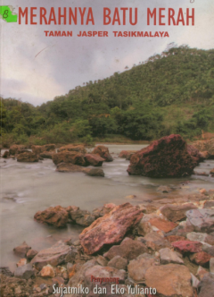
Merahnya batu merah : Taman jasper Tasikmalaya
Buku ini berisi bunga rampai beragam karya tulis yang memperlihatkan empati berbagai kalangan masyarakat pada keberadaan pusaka geologis batu merah jasper di Kecamatan Tasikmalaya, Jawa Barat.
- Edisi
- -
- ISBN/ISSN
- -
- Deskripsi Fisik
- 184p.,ill. 14 x 21 cm
- Judul Seri
- -
- No. Panggil
- 553.5 IKO m
 Karya Umum
  Filsafat
  Agama
Agama  Ilmu-ilmu Sosial
  Bahasa
  Ilmu-ilmu Murni
  Ilmu-ilmu Terapan
  Kesenian, Hiburan, dan Olahraga
  Kesusastraan
  Geografi dan Sejarah