Ditapis dengan
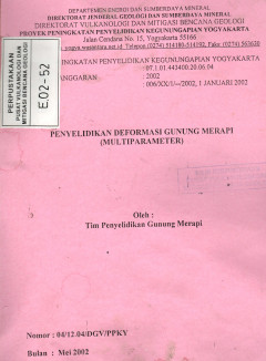
Penyelidikan Deformasi Gunung Merapi (Multiparameter)
Salah satu metoda yang digunakan untuk memantau/menyelidiki aktivitas gunungapi adalah metode Deformasi, dimana metode ini berdasarkan pada perubahan fisik gunungapi. Perubahan bentuk tubuh gunung yang terjadi akibat adanya proses migrasi magma dan tekanan magma yang menuju permukaan disebut dengan gejala deformasi.
- Edisi
- -
- ISBN/ISSN
- -
- Deskripsi Fisik
- 14 hlm;grafik;foto
- Judul Seri
- -
- No. Panggil
- PVG E.02-52
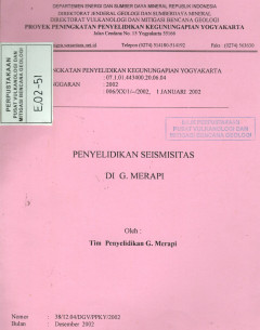
Penyelidikan Seismisitas Di G. Merapi
Setiap kali gunung Merapi akan meletus selalu didahului oleh meningkatnya aktivitas baik kegempaan maupun deformasi yang tidak bisa diamati dan dirasakan oleh manusia, tetapi bisa dirasakan atau di deteksi dengan peralatan geofisika seperti tilt meter dan seismometer, oleh karena itu untuk memantau aktivitas gunung merapi khusunya kegempaannya maka kontinuitas dan kualitas rekaman data gempa pe…
- Edisi
- -
- ISBN/ISSN
- -
- Deskripsi Fisik
- 9 hlm;grafik;tabel
- Judul Seri
- -
- No. Panggil
- PVG E.02-51

Laporan Pengamatan Visual, Seismik dan Perbaikan Peralatan Di Pos Pengamatan …
Gunungapi slamet merupakan gunungapi tertinggi di Provinsi Jawa Tengah dengan ketinggian kira kira 3432 meter diatas permukaan laut. Berbentuk kerucut dan tampak simetris apabila terlihat dari sebelah timur dan memanjang dari bagian Utara dan Selatan, terletak di perbatasan Kabupaten Tk.II Pemalang, Brebes, Tegal, Banyumas dan Purbalingga.
- Edisi
- -
- ISBN/ISSN
- -
- Deskripsi Fisik
- 15 hlm;tabel;foto;peta
- Judul Seri
- -
- No. Panggil
- PVG E.02-25

Pengembangan Sistem Pemantauan Gunungapi Terpadu (Regional Center) G. Guntur,…
Direktorat Vulkanologi dan Mitigasi Bencana Geologi (DVMBG), Direktorat Jenderal Geologi dan Sumberdaya Mineral, Departemen Energi Dan Sumber daya Mineral, memiliki wewenang untuk melakukan pengamatan, pemantauan dan penjagaan terhadap 129 ginungapi aktif di Indonesia melalui 68 pos pengamatan gunungapi.
- Edisi
- -
- ISBN/ISSN
- -
- Deskripsi Fisik
- 12 hlm;gambar;tabel
- Judul Seri
- -
- No. Panggil
- PVG E.02-15

Laporan Pemetaan Kawasan Rawan Bencana Gunungapi Merapi, Jawa Tengah
Sebagai gunungapi paling aktif di indonesia bahkan di dunia, G. Merapi telah banyak menarik banyak ilmuwan kebumian pada umumnya dan kegunungapian pada khususnya untuk mempelajari berbagai aspek tentang gunungapi tersebut. G.Merapi juga merupakan laboratorium alam kegunungapian dan salah satu Pos Pengamatan Gunungapi yang mempunyai peralatan monitoring paling lengkap di Indonesia.
- Edisi
- -
- ISBN/ISSN
- -
- Deskripsi Fisik
- 34 hlm;tabel;peta;foto
- Judul Seri
- -
- No. Panggil
- PVG E.02-10

Laporan Kegiatan Penyuluhan/Bimbingan Gunungapi Kelut Di Propinsi Jawa Timur
Mengacu pada keputusan Menteri Energi dan Sumber Daya Mineral Nomor 1915 Tahun 2001 Tentang Organisasi dan Tata Kerja Departemen Energi dan Sumber Daya Mineral Pada Pasal 486 butir (1), Seksi Bimbingan mempunyai tugas: menyiapkan bahan penyusunan, pengawasan dan evaluasi bimbingan teknis pameran dan publikasi; penyuluhan mitigasi bencana bagi penduduk yang bermukim di kawasan rawan bencana gunu…
- Edisi
- -
- ISBN/ISSN
- -
- Deskripsi Fisik
- 5 hlm;tabel;foto
- Judul Seri
- -
- No. Panggil
- PVG E.02-6

Inventarisasi Bahan Galian Gunungapi Papandayan dan Sekitarnya Kab. Garut, Ja…
secara geografi gunungapi papandayan termasuk kedalam wilayah kabupaten Garut, jawa barat dengan puncak tertinggi 2665 meter diatas permukaan air laut atau 1950 di atas dataran Garut. G. Papandayan merupakan gunungapi aktif berbentuk strato dibangun oleh pergantian anatara perlapisan aliran lava dan endapan piroklastik. Erupsinya sering berpindah pusat dari satu kawah ke kawah lainnya sehingga …
- Edisi
- -
- ISBN/ISSN
- -
- Deskripsi Fisik
- 30 hlm;gambar;peta
- Judul Seri
- -
- No. Panggil
- PVG E.02-4

Laporan Pembuatan Dokumentasi Gunungapi Guntur, Kab. Garut Prov. Jawa Barat
Gunungapi guntur secara administratif terletak di kabupaten Garut, merupakan salah satu gunungapi aktif di jawa barat. Puncak kerucut yang tertinggi dikenal sebagai gunung masigit dengan ketinggian 2248 m diatas permukaan laut, sedangkan ketinggian dari kota garut adalah lebih kurang 1550 meter. Gunung guntur merupakan salah satu nama puncak yang masih aktif dari suatu kelompok besar gunung.
- Edisi
- -
- ISBN/ISSN
- -
- Deskripsi Fisik
- 11 hlm;gambar;foto
- Judul Seri
- -
- No. Panggil
- PVG E.00-29

Laporan Pengamatan Kegempaan dan Visual Gunungapi Raung Jawa Timur
Salah satu realisasi dari tugas nyata proyek penyelidikan dan pengamatan gunungapi, oleh staf pengamatan seksi jawa Bagian Timur, Subdit Pengamatan gunungapi, Direktorat Vulkanologi pada tahun anggaran 2002 adalah melakukan penyelidikan/pengamatan visual dan kegempaan gunungapi Raung, yang pelaksanaannya bersamaan dengan penyelidikan/pengamatan kompleks Kawah Dieng.
- Edisi
- -
- ISBN/ISSN
- -
- Deskripsi Fisik
- 15 hlm;gambar;foto
- Judul Seri
- -
- No. Panggil
- PVG E.02-2

Makalah Karakteristik Magma Gunungapi Ciremai Jawa Barat Berdasarkan Analisis…
Penyelidikan petrologi dan geokimia batuan merupakan salah satu komponen yang erat hubungannya dengan serangkaian penyelidikan gunungapi. Batuan vulkanik baik lava, piroklastik maupun lahar merupakan hasil kegiatan suatu gunungapi. Lava dan piroklastik dari suatu gunungapi merupakan batuan yang dihasilkan langsung oleh magma, yang selama perjalanannya nai ke permukaan telah melalui berbagai pro…
- Edisi
- -
- ISBN/ISSN
- -
- Deskripsi Fisik
- 15 hlm;tabel;gambar
- Judul Seri
- -
- No. Panggil
- PVG E.01-33
 Karya Umum
  Filsafat
  Agama
Agama  Ilmu-ilmu Sosial
  Bahasa
  Ilmu-ilmu Murni
  Ilmu-ilmu Terapan
  Kesenian, Hiburan, dan Olahraga
  Kesusastraan
  Geografi dan Sejarah