Ditapis dengan

Laporan Kegiatan Gunung Semeru Bulan April, Mei, Juni Dan Juli 1961 dan Lapor…
Pada bulan Juni 1961 dari Jawatan geologi. Ururan volkanologi dilancarkan pemeriksaan kepuncak mahameru kawah Djonggring seloko dan penulis berkenan mengikuti rombongan ekspedisi yang di pimpin oleh Sdr. I. Soenarja
- Edisi
- -
- ISBN/ISSN
- -
- Deskripsi Fisik
- 38 hml.; gmbr.; peta
- Judul Seri
- -
- No. Panggil
- PVG E.61-7

Urusan Gunung Api, Pusat Jawatan Geologi; Laporan G. Galunggung 15 Djanuari 1958
Pada tgl. 2 Djanuari1958 diterima berita dari Kantor Kepresidenan Priangan dengan perantaraan telpun, bahwa bupati tasikmalaya mengabarkan G. Galunggung mengeluarkan asap terkepul membubung tinggi dan mengharap pemeriksaan dari Urusan Gunung Api.
- Edisi
- -
- ISBN/ISSN
- -
- Deskripsi Fisik
- 10 hml.; gmbr
- Judul Seri
- -
- No. Panggil
- PVG E.58-1

Pemeriksaan Kimia Dua Sumber Mineral di Kaki Timur G. Ciremai, Desa Sangkanur…
Tuan Junghuhn membahas mataair ini sbb 'sumber ini, lk 1400 kaki dml di dekat kp. Sangkanurip, bernata air langsung dekat alur Cian-par. Suhu airnya 32.4 deg R atau 105 deg F pada derajat panas cuaca 19.5 deg R atau 76 deg F dan 19.1 ^ 0 R dari air anak sungai (pk. 8 pada 19 Agustus 1837). Rasanya memualkan dan berbau gas zat air belerang. Sumber ini membual dari bongkah-bongkah puing (batu gul…
- Edisi
- -
- ISBN/ISSN
- -
- Deskripsi Fisik
- 7 hml
- Judul Seri
- -
- No. Panggil
- PVG E.061-1

Daftar peilschaal dari air ranu KLAKAH dan ranu PAKIS dan debietnja serokan t…
- Edisi
- -
- ISBN/ISSN
- -
- Deskripsi Fisik
- 14 hml.; tabel
- Judul Seri
- -
- No. Panggil
- E.52-11
- Edisi
- -
- ISBN/ISSN
- -
- Deskripsi Fisik
- 14 hml.; tabel
- Judul Seri
- -
- No. Panggil
- E.52-11

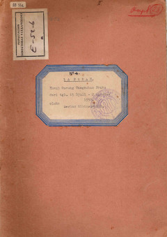
Laporan Kawah Gunung Tangkuban Perahu
Keadaan sehari-hati dari pondok Tangkuban Parahu tgl. 15/7 - 2/8-' 52
- Edisi
- -
- ISBN/ISSN
- -
- Deskripsi Fisik
- 10 hml.; gmbr
- Judul Seri
- -
- No. Panggil
- PVG E.52-6

Laporan Pemeriksaan dan Peninjauan Kawah G. Tangkuban Perahu 1952
Laporan G. Tangkuban Prahu dari tgl 13/6-'52 s/d 20 djuni 1952,- telah dikirim sebagai laporan mingguan.
- Edisi
- -
- ISBN/ISSN
- -
- Deskripsi Fisik
- 15 hml.; gmbr.; tabel.; peta
- Judul Seri
- -
- No. Panggil
- PVG E.52-5

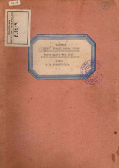
Laporan Gunung-Gunung berapi Djawa Timur Maret-April 1952
- Edisi
- -
- ISBN/ISSN
- -
- Deskripsi Fisik
- 48 hml.; gmbr.; tabel.; peta
- Judul Seri
- -
- No. Panggil
- PVG E.52-4
- Edisi
- -
- ISBN/ISSN
- -
- Deskripsi Fisik
- 48 hml.; gmbr.; tabel.; peta
- Judul Seri
- -
- No. Panggil
- PVG E.52-4

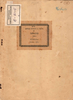
Laporan Ringkas Gunung Kelut di Jawa Timur
Atas perintah tilgram tg. 1/10-151 No.1912 dari Kep Porw Djwt. Pertambangan Bindung, disertai dengan surat perintah Ketur Kantor Tiabang Djawatan Pertambangan Jogjakarta to. 3/10-151 -No.169/Um., penulis diberi tugt.s membantu mengawasi/menjelidi-Iti di G. Kelut, Pada tg. 14/10-151 dengan Sdr. Teknd dari Bandung, seje bertemu di station Jogjakarta dan selandjutnja kami bersame-s4-mt. meneruskan…
- Edisi
- -
- ISBN/ISSN
- -
- Deskripsi Fisik
- 9 hml.; gmbr.; peta
- Judul Seri
- -
- No. Panggil
- PVG E.51-5

Daftar Peilschaal Dari Air Ranu KLAKAH dan Ranu PAKIS, dan DEBIETNYA Serokan …
- Edisi
- -
- ISBN/ISSN
- -
- Deskripsi Fisik
- 14 hml.; tabel
- Judul Seri
- -
- No. Panggil
- PVG E.51-2
- Edisi
- -
- ISBN/ISSN
- -
- Deskripsi Fisik
- 14 hml.; tabel
- Judul Seri
- -
- No. Panggil
- PVG E.51-2

Pemeriksaan Cipanas Sangkanurip dan G. Kromong
Tgl. 1 Djanuari 1951. Di kampung Timbang, Kawadanan Tj1limus, di kaki G. Tjiremai sebelah Timur, ada keluar mata air panas (Jo-diumbron) jang telah lama digunakan oleh umum untuk berobat dan disitu didirikan oleh Kota Pradja Tjirebon suatu Pesanggrahan (Pe-nginapan) jang digunakan untuk pemandian.
- Edisi
- -
- ISBN/ISSN
- -
- Deskripsi Fisik
- 4 hml.; gmbr.; tabel
- Judul Seri
- -
- No. Panggil
- PVG E.51-1
 Karya Umum
  Filsafat
  Agama
Agama  Ilmu-ilmu Sosial
  Bahasa
  Ilmu-ilmu Murni
  Ilmu-ilmu Terapan
  Kesenian, Hiburan, dan Olahraga
  Kesusastraan
  Geografi dan Sejarah