Ditapis dengan
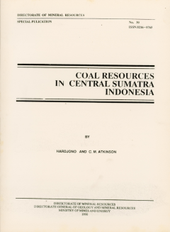
Coal resources in central Sumatra Indonesia
This report which describes the geological setting and physical features of the most important coal deposits in Central Sumatra is based on detailed studies over 13 years by the Sub-Directorate of Coal and Peat Exploration, which is the most experienced and well equipped government coal exploration group in this country. The Sub-Directorate of Coal and Peat Exploration within the Directorate…
- Edisi
- -
- ISBN/ISSN
- 0216-0765
- Deskripsi Fisik
- 40p.,ill. 14 x 21 cm
- Judul Seri
- -
- No. Panggil
- PK No. 30
The Stratigraphy And Nature Of The Stratoone Of Mt. Cemara Lawang In The Brom…
The statocone of Mt. Cemara Lawang is part of The Mt. Bromo-Tengger volcano complex, East Java, Indonesia. Mt. Cemara Lawang is comosed of a sequences of deposits, comprising the big feldspar lava, andesite lava, phreatomagmatic ash fall, phreatic, basalt lava, basaltic andesite lava, andesite lava, alternating layers of pyroclastic fall and flow and the brown ash fall deposits from the oldest …
- Edisi
- -
- ISBN/ISSN
- -
- Deskripsi Fisik
- 228 hal.; gbr.; tabel; foto
- Judul Seri
- -
- No. Panggil
- PVG (043)551.7(E3) ZAE s c.1
The Evolving Anatomy of a Collapsing Orogen
The late Mesozoic and Cenozoic convergence between Europe and Africa led to the Alpine mountain belt. In this thesis we will focus on the Aegean segment of this belt.
- Edisi
- -
- ISBN/ISSN
- 90-5744-103-9
- Deskripsi Fisik
- 280 hal,; gbr.
- Judul Seri
- -
- No. Panggil
- PVG (043)551 HIN E c.1
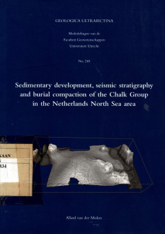
Sedimentary Development, Seismic Statigraphy and Burial Compaction of The Cha…
The Chalk Group accumulated during a 40 million-year episode of the Earth's history (100-61 Ma BP) during which intense volcanic activity at oceanic spreading ridges coincided with globally high sea levels, high sea-surface temperatures and a peak in coincided with globally high sea levels, high sea-surface temperatures and a peak in the production of organic matter.
- Edisi
- -
- ISBN/ISSN
- -
- Deskripsi Fisik
- 175 hlm.;gbr.
- Judul Seri
- -
- No. Panggil
- PVG (043)550.834 MOL s c.1
A Study of The Stratigraphy, Volcanology and Geochemistry of Pyroclastic Rock…
The Ijen caldera complex is located in an active tectonic region, where the Indian plate is now sliding approximately northward beneath Java at about 6-7 cm/yr. This study is in two parts, the firs is detailed field mapping and includes a geological map and stratigraphy, which form the basis for other work. The second concentrates on the post-caldera pyroclastic deposits.
- Edisi
- -
- ISBN/ISSN
- -
- Deskripsi Fisik
- 193 hal.; gbr.; lamp.; tabel.
- Judul Seri
- -
- No. Panggil
- PVG (043)551.7 SUN s c.1
Petrologie et Geochimie Du Volcan Lamongan, Java-Indonesie
A I'heure actuelle, I'Indonesie possede 129 volcans en activite. Ces derniers se succendent depuis I'ile de Sumatra jusqu'aux Celebes et a la mer de Banda.
- Edisi
- -
- ISBN/ISSN
- -
- Deskripsi Fisik
- 78 hal.; gbr.; peta; tabel.
- Judul Seri
- -
- No. Panggil
- PVG (043)552(E2) MUL p c.1
Volcanic Stratigraphy Geochemistry of The Idjen Caldera Complex,East Java Ind…
The Idjen caldera is classed as a Krakatoa type or stratocone caldera and is characterized by a caldera floor, a caldera escarpment, and older volcanic forms. The caldera diameter rangers from 14 by 16 km at the rim to 11 14 km at the floor with a maximum depth of 709m.
- Edisi
- -
- ISBN/ISSN
- -
- Deskripsi Fisik
- 144 hal,; gbr.; lamp.; tabel.
- Judul Seri
- -
- No. Panggil
- PVG (043)551.7(E3) SIT v c.1
Early Archaean Sedimentary Basins : Depositional Environmemt And Hydrothermal…
Sedimentary basins are well studied topic in geology, much is known about the setting in which they form, and the different type of basing fills. Less is know about basin early on in Earth history, particularly in the early Archens.
- Edisi
- -
- ISBN/ISSN
- -
- Deskripsi Fisik
- 159 hal,; gbr.; lamp.; tabel.
- Judul Seri
- -
- No. Panggil
- PVG (043)551 VRI e c.1
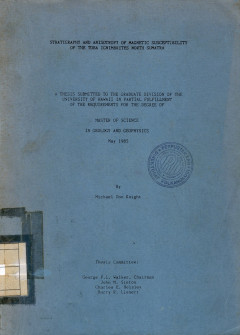
Stratigraphy And Anisotropy Of Magnetic Susceptibility Of The Toba Ignimbrite…
This study was part of a cooperative project with the Indonesian Institute of Sciences, Bandung, Java, the Michigan Technological University group (W.I Rose, Jr., principle investigator) and the Hawaii Institute of Geophysics, University of Hawaii group (G.P.L. Walker, principle investigator).
- Edisi
- -
- ISBN/ISSN
- -
- Deskripsi Fisik
- 237 hlm.;gbr.
- Judul Seri
- -
- No. Panggil
- PVG (043)551.7(A) KNI s c.1
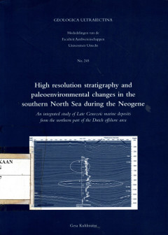
High Resolution Stratigraphy and Peleoenvironmental Changes in The Southern N…
Today's continental shelves, such as the one covered by the North Sea, are products of the last post-glacial sea-level rise of the glacial era that began in the Late Pliocene and continued until today. The sedimentary history of shelf seas reflects the changing relationship between tectonic subsidence, sea level oscillations and (hydro-) dynamics processes.
- Edisi
- -
- ISBN/ISSN
- 90-5744-106-3
- Deskripsi Fisik
- 205 hlm.;gbr.
- Judul Seri
- -
- No. Panggil
- PVG (043)551.7 KUH h c.1
 Karya Umum
  Filsafat
  Agama
Agama  Ilmu-ilmu Sosial
  Bahasa
  Ilmu-ilmu Murni
  Ilmu-ilmu Terapan
  Kesenian, Hiburan, dan Olahraga
  Kesusastraan
  Geografi dan Sejarah