Ditapis dengan

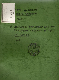
The Kelud, Volcanic Earthquakes At Lamongan Volcano In 1924
Volcanic quakes occurred since September 20,1924. E and Ne of Ranu Klakah treasures were formed. The tromometers Klakah repetend in October 135, in September 81, in December 105 shocks.
- Edisi
- -
- ISBN/ISSN
- -
- Deskripsi Fisik
- 18 hml.; tabel
- Judul Seri
- -
- No. Panggil
- PVG E.23-1

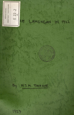
The Lamongan in 1922
During 1922 the G. Lamongan was often visited by the volcano guideship survey namely in April, June and August.
- Edisi
- -
- ISBN/ISSN
- -
- Deskripsi Fisik
- 6 hml.; tabel
- Judul Seri
- -
- No. Panggil
- PVG E.22-2

The Aquatic Transportation of The Semeru - Products The Wet Danger
of much more importance of the surrounding plains of the Senera is tow aquatic transportaton of the ejected products, the was danger. When we travel the area between Lunajang and Pasirian and the S foot of the volcano till the Kali Glidik, then it becomes clear to anybody which role the aquatic transportation of the Semeru products fulfils in the economic life of the here established populat…
- Edisi
- -
- ISBN/ISSN
- -
- Deskripsi Fisik
- 12 hml
- Judul Seri
- -
- No. Panggil
- PVG E.22-3

Small Eruption on December 6-7, 1920 in the Craterlake of G. Kelud
Except by the already quite quickly after-supply of water in the crater established calving off of the craterwall, the topography of the crater and therefore the correctness of the calculation of the supplied water was much more seriously hindered by a small eruption in the craterlake, which took place in the night of December6 to 7, 1928 (The big eruption lasted May 1920, 1919. Translater).
- Edisi
- -
- ISBN/ISSN
- -
- Deskripsi Fisik
- 3 hml
- Judul Seri
- -
- No. Panggil
- PVG E.20-2

The Eruptions In Kawah Baru, G.Papandayan In 1924, The Activity In Kawah Nang…
The eruptions, which in the course of 1924 took place in Kavah Baru, were all of relative short duration. In many cases the activity was restricted to the geyserlike spouting-up of mud from one of the crater openings, which in the course of 1923 were born. Sometines also new craterlats were formed, or except mud also stones were ejected. Naturally the gaspressure at lastnaned eruptions was much…
- Edisi
- -
- ISBN/ISSN
- -
- Deskripsi Fisik
- 15 hml
- Judul Seri
- -
- No. Panggil
- PVG E.25-2

The G. Kelud in 1924
Phenomena which would indicate on an increased activity on the Kelut were not observed during 1924 and in the beginning of 1925. A fow light earthshocks, which were felt in the lowercamp, appeared to be of tectonic origin.
- Edisi
- -
- ISBN/ISSN
- -
- Deskripsi Fisik
- 7 hml.; tabel
- Judul Seri
- -
- No. Panggil
- PVG E.24-4

The 1885 Disaster of Semeru Volcano
In 1885 a part of the southen collapse due to the pressure of the lava in the Semeru
- Edisi
- -
- ISBN/ISSN
- -
- Deskripsi Fisik
- 5hlm
- Judul Seri
- -
- No. Panggil
- PVG E.24-2

The G. Lamongan
Although several times from the surroundings of the Lamongan nevs arrived on eruptions of the volcano, after further investigation appeared, that the observed abnormal phonomena are not to be ascribed to volcanic activity.
- Edisi
- -
- ISBN/ISSN
- -
- Deskripsi Fisik
- 7 hml
- Judul Seri
- -
- No. Panggil
- PVG E.23-2

Excentric Eruptions of G.Lamongan
Of more importance than the flank eruptions are the excentric eruptions, which are fed from a much more deeper lavaniveau than the first mentioned, whereas the breakthrough mostly takes place in the area of the volcano foot. Also excentric eruptions may entirely independently become active fron the main crater, which at flankeruptions is not likely possible. Also the phenomena, with which excen…
- Edisi
- -
- ISBN/ISSN
- -
- Deskripsi Fisik
- 15 hml.; tabel
- Judul Seri
- -
- No. Panggil
- PVG E.22-1

The Lamongan
At the end of February 1920 by the Sectionhead of the Irrigation at Lumajang was reported, that in that month an abnormal drop of the waterlevel of the Ranu's Klakah and Pakis had taken place. If the Ranu Klakah in normal times always flowed through his nator al outlet, at present it is not like this, as the lake level has drop till 1.5 m below the outlet This even happens during the full W …
- Edisi
- -
- ISBN/ISSN
- -
- Deskripsi Fisik
- 11 hml
- Judul Seri
- -
- No. Panggil
- PVG E.21-8
 Karya Umum
  Filsafat
  Agama
Agama  Ilmu-ilmu Sosial
  Bahasa
  Ilmu-ilmu Murni
  Ilmu-ilmu Terapan
  Kesenian, Hiburan, dan Olahraga
  Kesusastraan
  Geografi dan Sejarah