Ditapis dengan

A Volcanological Investigation Of Three Important Recent Eruptions in Indones…
Krakatau was studied from September 10 - 12. The 1883 eruption produced a large non - walded ignimbrite deposit (ash - flow) which covers large areas of Rakata, Sertung and Rakata Islands. We landed on all three islands at accesible points and axamined coastal exposures of the 1883 deposit.
- Edisi
- -
- ISBN/ISSN
- -
- Deskripsi Fisik
- 12 hlm; gmbr; peta
- Judul Seri
- -
- No. Panggil
- PVG A.79-8

Fundamentals of Geographic Information Systems
This is a book about geography. It is also about Geographic Information Systems (GIS) – a fundamental set of automated ideas and concepts rooted in over 2500 years of explorations and geographic research (Dobson, 1995) and designed to provide answers to questions based on mapped data. As a practicing geographer I have long been intrigued by the idea of geographer as explorer.
- Edisi
- -
- ISBN/ISSN
- 0-471-14284-3
- Deskripsi Fisik
- 479 hal; photo; lamp.
- Judul Seri
- -
- No. Panggil
- PVG 911 DEM F c.1

Kehidupan Prasejarah: Ensiklopedia Ringkas untuk Anak
- Edisi
- -
- ISBN/ISSN
- 978-602-02-9129-1
- Deskripsi Fisik
- 31 hlm.
- Judul Seri
- -
- No. Panggil
- PSG 551.7(031) HAR k
- Edisi
- -
- ISBN/ISSN
- 978-602-02-9129-1
- Deskripsi Fisik
- 31 hlm.
- Judul Seri
- -
- No. Panggil
- PSG 551.7(031) HAR k

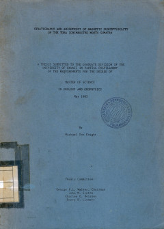
Stratigraphy And Anisotropy Of Magnetic Susceptibility Of The Toba Ignimbrite…
This study was part of a cooperative project with the Indonesian Institute of Sciences, Bandung, Java, the Michigan Technological University group (W.I Rose, Jr., principle investigator) and the Hawaii Institute of Geophysics, University of Hawaii group (G.P.L. Walker, principle investigator).
- Edisi
- -
- ISBN/ISSN
- -
- Deskripsi Fisik
- 237 hlm.;gbr.
- Judul Seri
- -
- No. Panggil
- PVG (043)551.7(A) KNI s c.1

Buku Pedoman Pengembangan Organisasi
- Edisi
- -
- ISBN/ISSN
- -
- Deskripsi Fisik
- xii + 222 hlm.; 24 cm
- Judul Seri
- -
- No. Panggil
- BPT 658.1 GIL b
- Edisi
- -
- ISBN/ISSN
- -
- Deskripsi Fisik
- xii + 222 hlm.; 24 cm
- Judul Seri
- -
- No. Panggil
- BPT 658.1 GIL b

Explosive Volcanism : Developments in Volcanology 3
- Edisi
- -
- ISBN/ISSN
- 44442251
- Deskripsi Fisik
- vii + 471 hlm.; 24 cm
- Judul Seri
- -
- No. Panggil
- BPT 551.21 SHE e
- Edisi
- -
- ISBN/ISSN
- 44442251
- Deskripsi Fisik
- vii + 471 hlm.; 24 cm
- Judul Seri
- -
- No. Panggil
- BPT 551.21 SHE e

GPS Land Navigation
- Edisi
- -
- ISBN/ISSN
- 965220257
- Deskripsi Fisik
- xv +254 hal.; 22,5 cm; indeks
- Judul Seri
- -
- No. Panggil
- BPT 912.014 FER g
- Edisi
- -
- ISBN/ISSN
- 965220257
- Deskripsi Fisik
- xv +254 hal.; 22,5 cm; indeks
- Judul Seri
- -
- No. Panggil
- BPT 912.014 FER g

Geological Society Memoir No. 27 : Pyroclastic Density Currents and The Sedim…
- Edisi
- -
- ISBN/ISSN
- 1862391246
- Deskripsi Fisik
- vii + 137 hlm.; 31 cm
- Judul Seri
- -
- No. Panggil
- BPT 551.21 BRA p
- Edisi
- -
- ISBN/ISSN
- 1862391246
- Deskripsi Fisik
- vii + 137 hlm.; 31 cm
- Judul Seri
- -
- No. Panggil
- BPT 551.21 BRA p

Water Supply and Sanitation Project Preparation Handbook
- Edisi
- -
- ISBN/ISSN
- -
- Deskripsi Fisik
- xvi + 331 hal.; 27,5 cm; ilus.
- Judul Seri
- -
- No. Panggil
- BPT 628.5 GRO w
- Edisi
- -
- ISBN/ISSN
- -
- Deskripsi Fisik
- xvi + 331 hal.; 27,5 cm; ilus.
- Judul Seri
- -
- No. Panggil
- BPT 628.5 GRO w

Menguasai Pembuatan Webdengan Office 97 Buku 3
- Edisi
- 3
- ISBN/ISSN
- 979-20-0480-7
- Deskripsi Fisik
- 132 hlm.; 23 cm
- Judul Seri
- -
- No. Panggil
- BPT 005.3 YOU m
- Edisi
- 3
- ISBN/ISSN
- 979-20-0480-7
- Deskripsi Fisik
- 132 hlm.; 23 cm
- Judul Seri
- -
- No. Panggil
- BPT 005.3 YOU m
 Karya Umum
  Filsafat
  Agama
Agama  Ilmu-ilmu Sosial
  Bahasa
  Ilmu-ilmu Murni
  Ilmu-ilmu Terapan
  Kesenian, Hiburan, dan Olahraga
  Kesusastraan
  Geografi dan Sejarah